Thursday, April 25, 2013

Native Americas (First Nations) - Visual Quick Study

- Click on any map for an enlarged version -

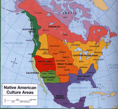
Native American Cultural Areas

North American - Native Language Groups

1600s


Distribution of the "Barbarous" Tribes East of the Mississippi    1491
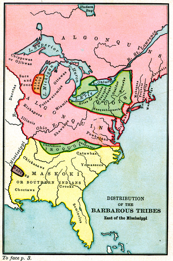
A map of the Native American families and groups in North America east of the Mississippi River circa 1491. 

Map of the Indian Families, 1650
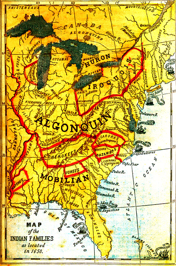
A map of the Native American families and groups in North America east of the Mississippi River as located in 1650. 

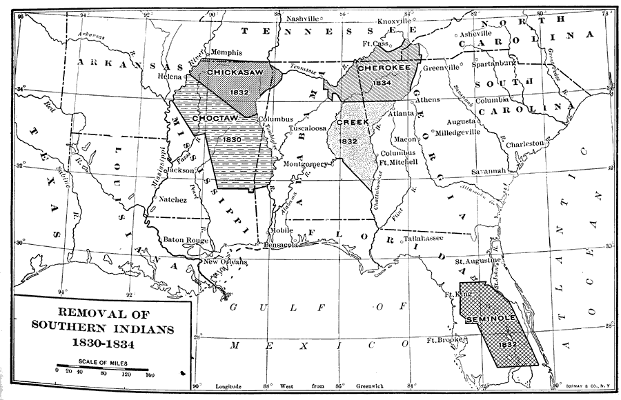
Removal of Southern Indians, 1830 to 1834

Forced Migrations


Native American Study 

  • Sad saga of deceit by U.S. government replete with colorful maps of Native North American Languages and the Trail of Tears   --  Recommended Reading >

Tuesday, April 23, 2013

Religion in America


America's Most (and Least) Religious Metro Areas

Religion in America has an unmistakable geographic dimension


Three of the top five most religious metros are in Alabama — Montgomery, Birmingham, and Huntsville. Jackson, Mississippi, also ranks among the top five.

Burlington, Vermont, and Boulder, Colorado, tie for the title of the nation's least religious metro area. In these two metros, fewer than one in five residents claim to be "very religious." San Francisco and Boston also rank among the least religious metros in America.

These patterns conform to the broader findings of political scientist Ronald Inglehart, whose detailed World Values Surveys identify the shift from religious to secular values as one part of the transition to more economically advanced societies. Politicos on the left and right like to explain religious voters' proclivity purely in terms of values. But this misses a central point - that religion is inextricably bound up with the nation's underlying economic and geographic class divide.


- See the Correlation - 

The Real Boundaries of the Bible Belt


Monday, April 22, 2013

Toxic Contamination From Natural Gas Wells

Pennsylvania: 
Toxic Contamination From Natural Gas Wells


Flash-based Interactive Map showing data collected from more than 200 natural gas wells. Very Interesting - be sure to interact with the map...


Saturday, April 20, 2013

Water Shortages


World Water Shortages


See the dramatic affects on the supply of water as climate change progresses...


U.S.A.


Article > (more maps and details)

Food production in the “breadbasket” of the U.S. depends on water from the Ogallala Aquifer. The Ogallala’s volume will fall a staggering 52 percent between 2010 and 2060.

See also an earlier post >


Friday, April 19, 2013

A 'Whom Do You Hang With?' Map Of America

A website that tracks the movement of dollar bills. 
Lines that the money rarely crossed are noted in blue. ^

Money-in-motion is one proxy for how people connect. 
Yakking on the phone is another. 

Pretty Interesting (especially the dollar tracking data build)


Thursday, April 18, 2013

The Shape of Song in Images

Chopin, Mazurka in F# Minor

The image illustrates the complex, nested structure of the piece.
Diagrams in The Shape of Song display musical form as a sequence of translucent arches. Each arch connects two repeated, identical passages of a composition. By using repeated passages as signposts, the diagram illustrates the deep structure of the composition.

This is cool!
Check out the interactive (wait till the java app loads)
Bach, Ravel, Miles Zavis, Isaac Hayes, Led Zeppelin, even DIY

Wednesday, April 17, 2013

Wednesday, April 10, 2013

Wednesday, April 3, 2013

The Great Pacific Garbage Patch

The Great Pacific Garbage Patch

Somewhere in the Pacific Ccean is a floating mass trapped by currents. Consisting mainly of plastic, it is almost three times the size of Spain and Portugal combined...


Convection Currents and The Convergence Zone

(The Pacific Gyre)


This article has some wonderful interactive animations