Sunday, March 22, 2015

Saturday, March 21, 2015

Interactive U.S./Canadian Railroad Maps

BNSF Interactive Network Map

“Highlighting events and activities along its 32,000-mile rail network"

Maps of the Union Pacific


Map Gallery >
"Union Pacific operates North America's premier railroad franchise,
covering 23 states in the western two-thirds of the United States."

CSX System Map

"How Tomorrow Moves..."

Norfolk Southern

Interactive Map >
"Norfolk Southern operates on nearly 22000 route miles in 22 states and D.C."


Canadian National Railway

"CN is your complete transportation and logistics solution."

Canadian Pacific

System Info >
“Our network is a one-stop shop for your dock-to-dock transportation needs.”


Monday, March 9, 2015

The Collapse of the American Shopping Mall


Did You Know?

About 15% of U.S. malls will fail or be converted into non-retail space within the next 10 years. Within 15 to 20 years, retail consultant Howard Davidowitz expects as many as half of America's shopping malls to fail. What will eventually replace these ghost malls are community colleges, business offices, and health care facilities.

Articles


Saturday, March 7, 2015

Unveiling the Past - Ghost Embankments

As I have posted earlier on this blog (DIY - Railroad History Research), finding “ghost Embankments” on topo maps is a great way to locate abandoned railroad lines.

A trek to a set of stacked abandoned railroad tunnels last December (Abandoned Railroad Tunnels) was an exciting venture “in the field.” The curious nature of two levels of tunnels was made even more clear when viewed on a map or satellite view.

Selecting the Topo choice in Acme Mapper shows where the old railroad lines where by clearly indicating embankments. Acme Topo Map

Overview of Newtown Railroads >

Go To Article for further details (more maps, etc.)


Monday, March 2, 2015

OpenStreetMap - A Decade of Growth

Watch a Decade of Data Come to Life on OpenStreetMap

Using GPS tools, satellite photographs, and their own local knowledge, citizen cartographers the world over have used the open-source platform to map the world little by little. From this, Mapbox has created a remarkable interactive that shows crowd-sourced geographic data “coming to life” across the globe…

Article >


Nixon's Internal Memos and the Birth of Amtrak

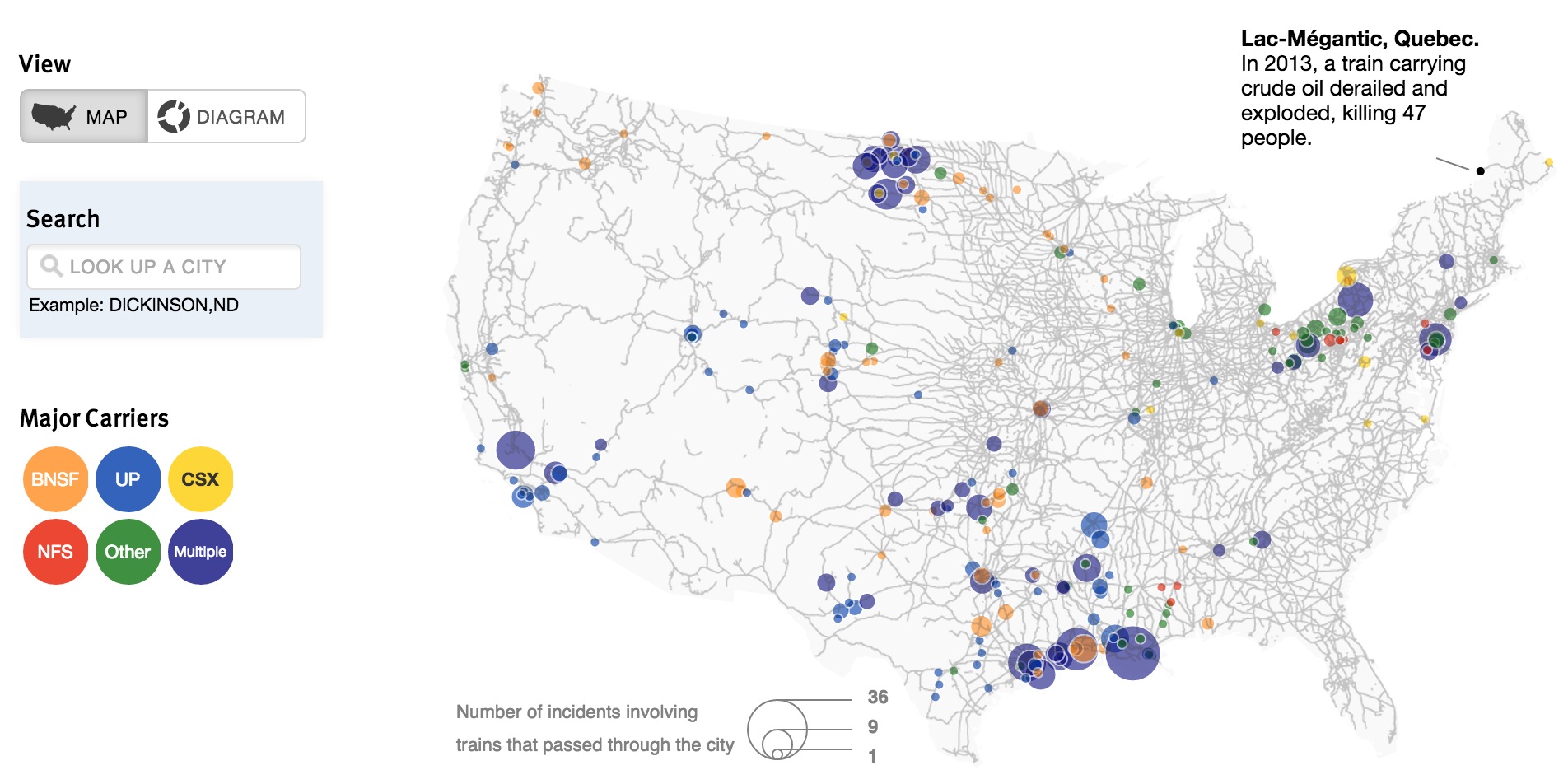
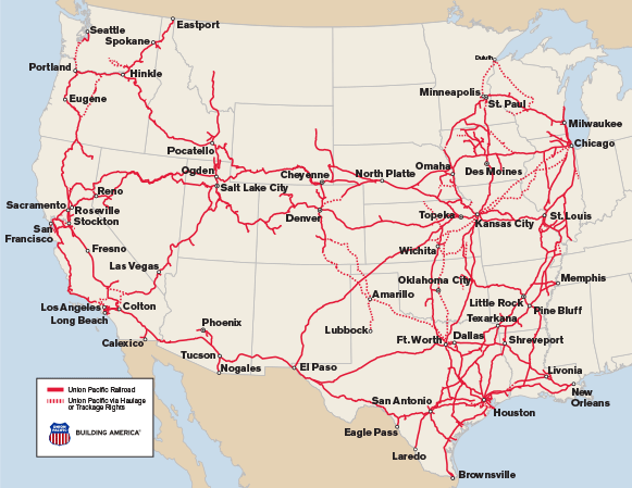
11 Historical Maps and Charts That Explain the Birth of Amtrak


Today America's passenger rail provider does still receive help from the federal government, but it also now recovers 93 percent of its operating costs through fares, and lately the service has broken ridership records year after year.

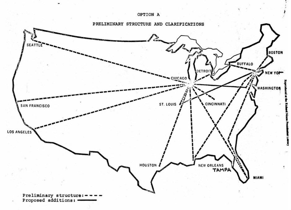
At it's inception, internal memos show Nixon’s calculated effort to score “political points”

Article >