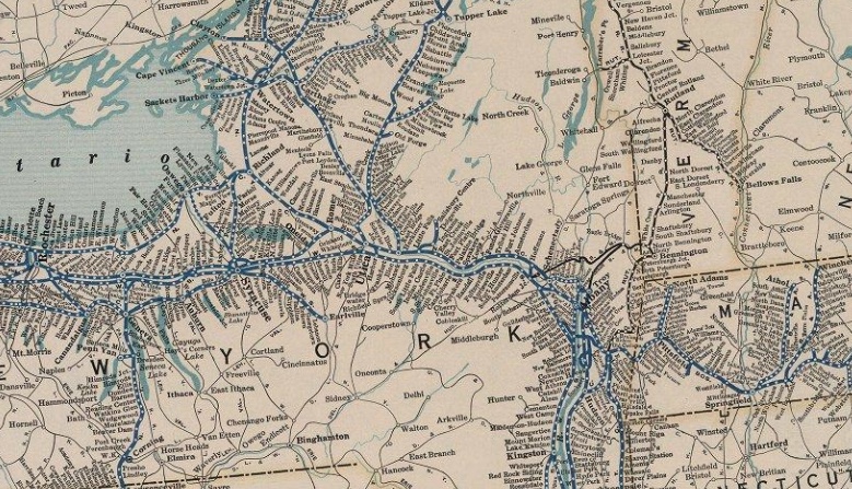
Showing posts with label U.S. Railroad Map. Show all posts

Friday, July 1, 2022

An Amazing Assortment of Railroad Maps

The David Rumsey Historical Map Collection has a great assortment of historical maps, including quite a few railroad maps. The interface to zoom in and pan is really well implemented and the maps listed below are wonderful visual references to the importance of railroading in the late 1800s and the turn of the century.

Erie Railroad - 1927

Interactive Map > 


Lackawanna Railroad.
The Road of Anthracite. Through Car Routes

Lovely Pamphlet >

Interactive Map > 


Santa Fe -  1904


Railways of Canada - 1886


Railroad map U.S. - 1890


Denver and Rio Grande Railroad System - 1883


Sunday, January 30, 2022

Sunday, August 9, 2020

More Railroad Maps

There's a wonderful site called Streamliner Memories that's filled with railroad memorabilia from the "Sliver Age" of streamliners. All types of Railroad Passenger Brochures, Dining Car Menus, Travel Advertisements can be found there.

These maps are screenshots of PDFs, Use the PDF link for higher resolution and/or downloading.
  • Click on any map for an enlargement
  • Click on the Source Link to view the PDF
The Chessie - 1960
(Chesapeake & Ohio RR) 
The Delaware & Hudson RR in the 1950s
Northern Pacific (Red) - Burlington (Brown)
1957
New York Central - 1953 brochure
Year-Round Travel Guide
Source
More from the NYC Travel Guide
Union Pacific RR - 1966

Monday, June 29, 2020

Shekomeko, New York

Shekomeko was a small historic hamlet in eastern Dutchess County, New York. Originally a village of Mahican Native Americans, the name Shekomeko was derived from their Algonquian language: she, -che (from mishe or k'che), 'great,' and comaco, 'house,' or 'enclosed place'—'the great lodge,', or 'the great village.'" 
(click on any graphic to enlarge)


Native Americans and the Moravian Mission 

The village has a fascinating history.  It was Moravian mission and in the summer 1742, Shekomeko was established as the first native Christian congregation in America. The increasing Moravian influence and their success with the Native Americans led to resentment by European settlers in the area. False rumors of atrocities were spread and the authorities were petitioned to intervene. A law was enacted on September 21, 1744 forbidding anyone from residing with Indians in order to Christianize them.
Shekomeko village and Moravian mission, 1745

By 1746, area settlers petitioned the governor to issue to them a warrant authorizing the killing of Shekomeko Indians. Shortly thereafter the mission was abandoned and the ten remaining families--a mere 44 persons where all that remained of the original 8,000 member tribe 100 years before--sought refuge in nearby Connecticut, while others traveled to Pennsylvania to be closer to the established Moravian settlements there.

A Railroad is Built

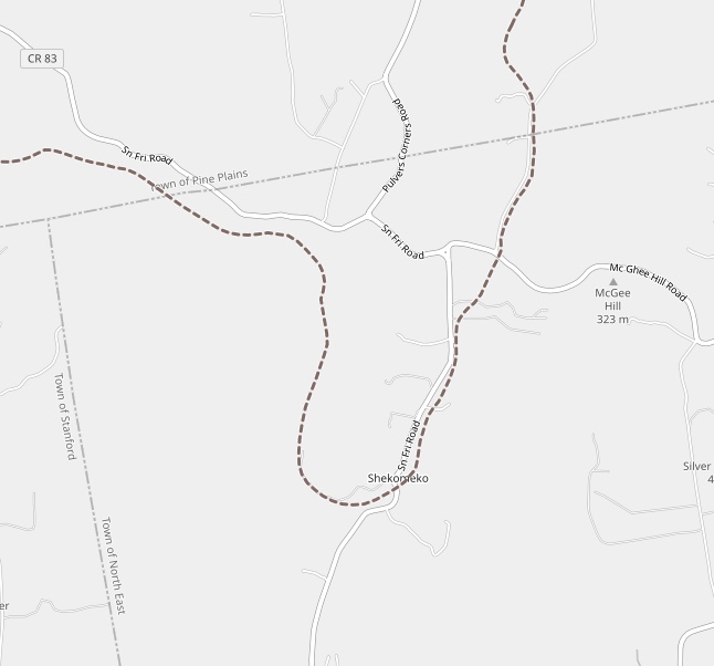
Construction on the Dutchess and Columbia Railroad began in 1868, and by 1869 the line reached north to Pine Plains. Construction then continued eastward through Shekomeko reaching Millerton in 1871. In 1877 the railroad was reorganized as the Newburgh, Dutchess and Connecticut Railroad (ND&C). In 1905 the New York, New Haven and Hartford Railroad acquired the ND&C and in 1907 merged it into the Central New England Railway.
Click any image to enlarge it


Sadly in 1925 the railroad line from Shekomeko east to Millerton was abandoned. Then in 1935, the line from Shekomeko west to Pine Plains  was abandoned and by 1938, the entire railroad line was abandoned. Traces of the roadbed can still be found in places.

Today

There's little left of the village now as this google aerial illustrates but there is a monument dedicated to the Moravian Christian Mission that was dedicated by the NY Moravian Historical Society in Oct 5, 1859.
Photo Credit: WindingRoad

Further Info

The Moravian Mission
(The Little Nine Partners Historical Society)

Shekomeko:
The Mohican Village that Shaped the Moravian Missionary World 

^ (excellent)

Shekomeko, New York (Wikipedia)

The Dutchess and Columbia Railroad
(The Little Nine Partners Historical Society)

History of the Moravian Church (Wikipedia)

Friday, May 3, 2019

Historic Map Overlays


What a great way to compare yesteryear history with today: Historic Map Overlays!


-Click on any map visit the page with the interactive map overlay-

Jersey City Rail Yards - Then and Now

Newport, NJ, now a a white-collar corporate enclave of high rises, chain stores and franchise restaurants was born on the ashes of former massive railroad yards. It’s a fascinating story of decline and revival...

Mystery Ruins

Unraveling the mysteries of a forgotten trolley bridge...
scroll to bottom of linked page

Sacandaga - Before and After

Flood On The Tracks - Last Days of the Gloversville And Northville. This interactive overlay  is  art of the Flood on the Tracks Presentation


Thursday, February 9, 2017

Antique Railroad Maps

Curious about the United States railroad history? (I find it fascinating). Besides the motherlode of early USGS topographical maps provided by the University of New Hampshire, wardmaps.com, mapsofthepast.com and a few other sites have a variety of interactive scalable antique map viewers. Here’s a sampling…

Map of the New York Central Lines 1904
Viewer:http://www.wardmaps.com/viewasset.php?aid=21105

Railroad Maps of the United States 1848
39 State and Regional Maps
Viewer:
Connecticut & Massachusetts & Rhode Island - 1925
Viewer:
United States - 1916 (New England)
Viewer:

Atlas of Railway Traffic Maps - 1922
by LaSalle Extension University - 15 maps

-1922-

Baltimore & Ohio Railroad
Santa Fe Railroad 1922
Burlington Route and Western Connections
Illinois Central Railroad and Other Eastern Lines
Southern Pacific Lines
Chicago Milwaukee & St. Paul Railroad
New York Central Railroad
Union Pacific System
Chicago & North Western Line
Pennsylvania Railroad System

Historic Railroad Maps
Atchison, Topeka and Santa Fe Railroad System 
Viewer:
http://www.mapsofthepast.com/old-railroad-maps


Trolleys/ Interurbans

Map of The Street Railways of Connecticut - 1912
Viewer:

Massachusetts Electric Railways - 1899
Viewer:

Thursday, February 4, 2016

Decline of U.S. Railroads - Animated Maps

Railroad History has always fascinated me. The two animated maps below vividly illustrate the huge loss of railroad passenger service across America...


Map from the National Association of Railway Passengers 
and Malcolm Kenton via Greater Greater Washington.
Animation by Joss Fong
Slowed Down by Rich Coffey

Article >


Watch: The slow, sad decline of Amtrak
Source: http://media.mnn.com/assets/images/2011/05/amtrak-timeline.gif

Article >


Saturday, January 30, 2016

1924 Snapshot of New York State’s Trolleys

A series of ten mobile-friendly zoomable maps of various regions of New York State, detailing the interurban systems in 1924. The interactive maps are the centerpiece of the site but timelines and an abundance of links to other sites on New York State trolleys create an interesting history-saturated "launching pad" for research on this subject.


Other New England States will eventually be added as all.

Northeast Interurbans (A 1924 Snapshot) >


Friday, January 8, 2016

Albany/Schenectady Area Trolleys

Two Highlights from a Web Site Detailing History in Upstate NY

Chock full of historical info and photos, maps and “trips in the field” - this site details history on railroads and trolleys in the area, Native Americans settlement in the area as well as how Glacier Flooding created the landscape.

The before and after is much better now!
Scroll to the bottom of the page
Then and Now
Trolley Bridge - Then and Now  Schenectady, NY
Interactive Map 
1924 Trolley Lines in the Albany/Schenectady Area
Interactive Map of Interurbans in the Albany/Schenectady Area- 1924 -

History Tidbits Home Page >


Tuesday, December 15, 2015

U.S. Railroads and Interurbans - YouTube Gems

U.S. Railroad History Map 1830 - 1990s


Nicely made short documentary

Why The U.S. Has The Worst Public Transit System


Interurban Railway Systems


Top Notch Investigative Journalism
“creating a whole new mindset... eliminate rail alternatives.. GM hit list”

Tuesday, November 10, 2015

1924 Rand McNally New York State Map

Awesome maps showing New York State railroads, interurbans and canal lines in 1924.
Great site - tons of material!

David Rumsey Historical Map Collection

Connecticut Railroad Valuation Maps

The University of Connecticut (uConn) and the Connecticut State Data Center (CTSDC) have done a wonderful job of providing access to a large series of 1915 New York, New Haven and Hartford Railroad Valuation Maps.

The Google-Driven interactive map to navigate through this series is truly a work of art!

I have colorized a few map selections of locations I am somewhat familiar with (and partial too :-) ). Click on any image to enlarge.

Trumbull - Along the Rail Trail

The Dam near the Tait's Mill Ruins
Ice House and Trumbull Pond 
Long Hill Station 

 Springdale, CT

There once was a station at the cemetery!

Springdale Station and Industrial Spurs

Newtown-Southbury


Echo Valley Road near Cavanaugh Pond


Pomperaug River Railroad Bridge - Southbury