Showing posts with label Native Americas. Show all posts

Monday, August 8, 2022

U.S. Indian tribes, reservations and settlements

Indian tribes, reservations and settlements in the United States 

1939 - Library of Congress Geography and Map Division


Saturday, May 29, 2021

Native American Names - Glastonbury CT Area

No matter where you may venture to in the U.S. -- it seems you can find tribute/evidence of native American origins if you know where to look...

  • Wangunk (“where the river bends”)
  • Nayaug  ("noisy waters")
  • Naubuc (flat plains to the north”)
  • Neipsic ("water near the hill") or Nipsic

The Native Americans of the present-day Glastonbury/Portland area were members of Algonkian-speaking tribes. They lived in clans of approximately 100 individuals and each group was ruled by a sachem or chief. Clans took names from features of the land where they were centered. Naubucs lived in the plains to the east, the flat area at the north end of town. Nayaugs lived a bit further south near the Noisy Water at the mouth of Roaring Brook (note: they were also known as the Red Hill Indians). Wangonks lived at the bend in the river behind today’s Town Hall, where the Connecticut River turned in the 1600s. The Neipsic springs first attracted Native Americans who came for the water's mystical healing powers. Today, the water still bubbles up from the hillsides in Glastonbury's J.B. Williams Park found on Neipsic Road.

The tribes were peaceful and farmed the land. In the summer, clans lived along the river in longhouses. In winter, they moved to the hills and lived in south- or west-facing caves. 


You can find the following names on the map above as well
  • Knogscut ("place of wild goose') - Knogscut Mountain >
  • Minnechaug ("berrylnd") - Even the golf course, when heading to Manchester, has a a Native American name!

Other Places Nearby

  • Meshomasic (“the great snake” or “land of many snakes”) - State Park >
  • Shenipsit (“at the great pool”) refers to the Shenipsit Lake, which the Shenipsit trail passes by

Friday, October 30, 2020

Native Lands (interactive map)

This is a fascinating Map

"View an online map that wipes away borders imposed by colonial powers to reveal a complex, colorful overlap of Indigenous territories, languages and treaties. Launched in 2015, the map draws on data from historic research, maps by Indigenous people, and ongoing input from people all over the world. Visitors can search for the roots of their own homelands and witness a view of the world that is almost never reflected on contemporary maps."

Native Lands - Interactive Map >

Note - it seems to not work with Chrome (try Firefox instead)


MapLab: Bearing Witness to Native Land

Related Article >

Friday, October 23, 2020

Native Americans - New Hampshire

Part 9 of an ongoing series on the history of Native American Territory as told through maps. This series is tagged as "Native American Map Series". It is recommended to visit all the Further Info links listed below for further study.

Native Americans - New Hampshire

For roughly 12,000 years, Indigenous peoples have lived where we now call "New Hampshire." The Abenaki tribe (together with the Maliseet, Passamaquoddy, Mi'kmaq, and Penobscot Indians), were members of the old Wabanaki Confederacy, adversaries of the Iroquois. These allies from the eastern seaboard spoke related languages, and Abenaki and Wabanaki have the same Algonquian root, meaning "people from the east."

The original inhabitants of the area that is now New Hampshire:

Source

There were three important subdivisions of the Abenaki tribe: the Sokoki (or Sokokis), the Cowasuck (Cowass or Coos), and the Missisquoi (or Mazipskwik.) 

Missiquoi Territory within the Larger Territory of the Western Abenaki Tribe

Although there is no local reservation or population center for the Native Americans, their names endure as names for modern-day cities, mountains and rivers:

  • Amonoosuc River ('manosek) – Western Abenaki for "fishing place."
  • Amoskeag Falls (namaskik) – Western Abenaki for "at the fish land."
  • Contoocook River (nikn tekw ok) – Abenaki for "to or from the head or first branch of the river."
  • Grand Monadnock (minoria denak) – Abenaki for "the bare or smooth mountain."
  • Kearsarge (g'wizawajo) – Western Abenaki for "rough mountain."
  • Massabesic Lake (massa nbes ek) – Abenaki for "to the great pond."
  • Merrimack River – Abenaki for "deep water or river."
  • Mount Pisgah – Abenaki for "dark."
  • Nashua– Abenaki for "two."
  • Sunapee Lake – Abenaki for "rock or mountain water."
  • Suncook River – Abenaki for "to the rocks."
  • Umbagog Lake  – Abenaki for "to the clear water lake."
Today
There are no federally recognized Indian tribes in New Hampshire today. Most Native Americans were forced to leave New Hampshire during the 1600's, when eastern tribes were being displaced by colonial expansion. The descendants of Indigenous populations who historically resided in New Hampshire can be found in several surrounding U.S. states and parts of Canada. 

Native Americans - Rhode Island

Part 8 of an ongoing series on the history of Native American Territory as told through maps. This series is tagged as "Native American Map Series". It is recommended to visit all the Further Info links listed below for further study.

Native Americans - Rhode Island

The lands of Rhode Island in the 1600s were mainly inhabited by three Native American tribes. To the east of the Narragansett Bay and the Providence River were the Wampanoags. On the south coast were the Eastern Niantics. The majority of Rhode Island was occupied by the Narragansetts.

The Narragansetts, in 1600, numbered around 4,000. Roger Williams settled among them and, through their favor, was able to found what became the Rhode Island colony in Providence. Although the colonists had peaceful relations with the Narragansetts, by 1675, the number of colonists had grown, pushing the Native Americans to the West. Indian land was seized at fwrfare erupted. Outnumbered and subsequently defeated, the power of the Native American tribes of southern New England was destroyed.

Many male Native American survivors were sold into slavery in the West Indies, while women and children were enslaved in New England. Remaining Narragansetts left the area and now the remainder of the tribe is living near Charlestown. Today, the Narragansetts are the only federally recognized Native American tribe in Rhode Island. Sourced from Native Americans shaped Rhode Island’s history

The original inhabitants of the area that is now Rhode Island: 

Source
Source

Today

The Naragansetts lost control of much of their tribal lands during the  late 19th century but they kept a group identity. The tribe incorporated in 1900 and they regained 1,800 acres of their land in 1978, finally gaining federal recognition as a tribe in 1983. According to tribal rolls, there are approximately 2,400 members of the Narragansett Tribe today. Google Map of Reservation

Native Americans - Massachusetts

Part 7 of an ongoing series on the history of Native American Territory as told through maps. This series is tagged as "Native American Map Series". It is recommended to visit all the Further Info links listed below for further study.

Native Americans - Massachusetts

Did you know the name "Massachusetts" is an Algonquian Indian word? It means "by the range of hills."

Early Contacts with Europeans
Prior to the well known Pilgrim arrival in 1620, the indigenous population had  numerous contacts with European explores along the coast. Starting in 1602, trading  with the Wampanoag and camps on Cape Cod were established.In 1605, French explorers led by Samuel de Champlain explored the Massachusetts coast. In 1605, French explorers led by Samuel de Champlain explored the Massachusetts coast and marveled at the abundant crops of corn, beans, squash, tobacco being cultivated by the Natives.

Disease
Between 1616 and 1619, it is estimated that at least three fourths of the Indian population in Massachusetts died from European epidemic diseases. Some authorities estimate the death toll at 90%.

The Pilgrims
When the Pilgrims arrived in 1620, they encountered few living people but saw evidence of many Indian graves.

Tribal Areas
The original inhabitants of the area that is now Massachusetts:

Source
Source


Statistics on the Catastrophic Population Decline
When the Pilgrims arrived in 1620, they found that much of the former Wampanoag towns had been decimated by a plague that spread through the population in 1617 and 1618.  Entire village had been wiped off the map. 
Source

Thanksgiving

Native American Territory - Maine

Part 6 of an ongoing series on the history of Native American Territory as told through maps. This series is tagged as "Native American Map Series". It is recommended to visit all the Further Info links listed below for further study.

Maine

The four Maine Indian tribes are the Maliseet, Micmac, Penobscot and Passamaquoddy, known collectively as the Wabanaki,

History

"Europeans first arrived in the Gulf of Maine in a series of exploratory voyages lasting roughly from 1524 to 1613. During this century of exploration, three themes emerged with lasting significance for the history of Maine.
  • First, in almost every instance, initial relations between English and Indian deteriorated quickly from friendship to suspicion and hostility, suggesting a deep flaw in English diplomatic approaches.
  • Second, these early voyages projected a false and ultimately dangerous impression of Maine as a New-World paradise where little work would yield great wealth.
  • Third, they laid the basis for overlapping French and English claims to the Wabanaki homeland that precipitated a three-way struggle for supremacy or survival that lasted for another century. These themes – diplomatic failure, false expectations, and imperial claims – explain much about Maine's marginal status as a proprietary colony and later as a province of Massachusetts." Source 

"Plagues that swept through the Indian villages beginning in 1616, killing more than 75 percent of the inhabitants and leaving the rest weakened culturally, spiritually, economically, and militarily. By the middle of the 17th century the Abenaki were living in a nightmarish landscape shaped by conflict, disease, and alcohol, and they turned to the missionaries for help and reassurance."

Summary

Between the late 17th century and the early 19th century, Great Britain, France, and others in Europe engaged in nearly constant warfare. The battles for economic and political power spilled into North America, catching the native populations in the middle. By the time a lasting peace came between France and Britain, European descendants had permanent settlements in North America and the native populations were relegated to the fringes. Source 

Today

Source

Native American Territory - Vermont

Part 5 of an ongoing series on the history of Native American Territory as told through maps. This series is tagged as "Native American Map Series". It is recommended to visit all the Further info links listed below for further study.

Vermont

The original inhabitants of the area that is now Vermont:
Source
Source
About the Abenaki
The Abenaki (also spelled Abnaki or Wabanaki) were an Algonquian-speaking North American Indian tribe that united with other tribes in the 17th century to furnish mutual protection against the Iroquois Confederacy. The name refers to their location “toward the dawn.” In its earliest known form, the Abenaki Confederacy consisted of tribes or bands living east and northeast of present-day New York state, and later the confederacy included some tribes as far south as present-day Delaware. Source

There were three important subdivisions of the Abenaki tribe: the Sokoki (or Sokokis), the Cowasuck (Cowass or Coos), and the Missisquoi (or Mazipskwik.) 

Missiquoi Territory within the Larger Territory of the Western Abenaki Tribe

Today

There are no federally recognized Indian tribes in Vermont today. Most tribes that once were native to Vermont ended up on reservations in Canada. 

Update: 
The Nulhegan Band of the Coosuk Abenaki Nation is nestled in N’dakinna (our homeland), the present-day Northeast Kingdom of Vermont. The tribal headquarters are located in Barton, Vermont.

Native American Territory - Connecticut

Part 4 of an ongoing series on the history of Native American Territory as told through maps. This series is tagged as "Native American Map Series". It is recommended to visit all the Further Info links listed below for further study.

Connecticut

As this Wikipedia page illustrates, there are quite a few places in Connecticut that have names of Native American origin:

  • Natick - Place of Hills
  • Housatonic - translated as "beyond the mountains"
  • Niantic River and Niantic village – For the Niantic tribe, called the Nehântick or Quinnipiac River – "long water land".
  • Hammonasset - “where we dig holes in the ground,” a reference to the tribe's agricultural way of life.
  • Aspetuck - "at the high place"
  • Naugatuck - "single tree
  • Shepaug - "great pond"
The various tribes that occupied Connecticut when the Europeans arrive spoke related Algonquian languages.
Iroquois | Algonquian
Map of Connecticut, circa 1625
Indian trails, villages, sachemdoms >
Wikipedia
Sadly due to smallpox and brutal wars and massacres by the white settlers, little remained of Native American population by the 1700s.

Today

Connecticut - American Indian Reservations >
Casinos and Museums
Today one of the most successful Indian Casinos in the country is Foxwoods. The Pequot tribe earnings from this business has enabled them to build a true state of the art museum nearby. A neighboring tribe, the Mohegans, soon followed with their own casino.

Native Americans - New England

Part 3 of an ongoing series on the history of Native American Territory as told through maps. This series is tagged as "Native American Map Series". It is recommended to visit all the Further info links listed below for further study.

Native Americans - New England

The indigenous tribes of the Northeast region of North America were among the first to have extended contact with European colonizers. Though members of numerous and separate tribes, the native people generally fell under the umbrella category of two main groups: Iroquoian and Algonquian. 

Source

Algonquian-speaking tribes lived primarily along the coast in socially and economically stable villages suited to fishing and farming. They were the larger of the two groups. Iroquoian-speaking tribes lived inland in smaller hamlets, near rivers and lakes, and relied on wild food. They tended to be warlike. 

Within both groups, a tribe consisted of several villages or hamlets joined in an alliance, called a confederacy. However, the stabilizing influence of these alliances provided no guarantee of peace among the tribes. Tribes within the Iroquois Confederacy would often raid others outside the protection of their alliance.

Native American settlements and trails in southern New England in the early 1600s
Source

Conflict

The arrival of Europeans and the subsequent spread of their colonies forced changes to the Native American ways of life and intensified the conflict between Iroquoian- and Algonquian-speaking groups. 

Perhaps the most troublesome of these was the concept of land ownership. To Europeans, ownership of land equated to wealth, and the New World seemed to offer unlimited possibilities to become land-rich. The native tribes, however, did not believe an individual could own land in this sense. Land could be used but not possessed, just as air might be used but not owned or kept. When Native Americans first shared the land with settlers, they did not understand that the settlers now would consider that land their property, would build fences, and would bar anyone else from using it.

All Texts Sourced From U.S. History/Northeast: 1620–1730


State-by-State Details

Thursday, October 22, 2020

Native American Conquest (Video Overviews)

Part 2 of an ongoing series on the history of Native American Territory as told through maps. This series is tagged as "Native American Map Series".

The two videos below do a great job of visually capturing the historical saga of Native American conquest and land loss.

European Conquest of the Americas

This is brilliant!  It should be a must read for all Americans!

This Land is My Land? 

The Legacy of Early Interactions Between Native Americans and Colonists

The British – who would later become the first “American citizens” – viewed the indigenous people as subordinate and uncivilized due to their nomadic lifestyles and “underutilization” of the land. Over a period of 300 years, from 1609 to 1900, Native American tribes went from inhabiting the entire land area, to living on specifically defined “native reservations.” Long before the founding of the United States, countless acres were taken through illegal treaties, trickery, and bloodshed.

These preliminary encounters between Native Americans and colonists laid the foundation for a tradition of land grabbing that repeated itself through the Revolutionary War of 1776, and especially later through policies of the United States federal government. Lest we forget: In the Americas, modern society was built on conquest, subordination murder and land-grabbing.


Wednesday, October 21, 2020

Indian (Native American) Territory

Western United States (Native American) Lands

This is the first introductory post of a upcoming series on the history of Native American Territory as told through maps. Forthcoming posts will be focused on a state-by-state basis whenever possible.  This series will be tagged as "Native American Map Series".

Note: All the David Ramsey Map Collection links will take you to an zoomable detailed version - it is highly recommended to use all these links provided for further study.

Northwest 1845 
David Ramsey Map Collection
US Population 1870
David Ramsey Map Collection
Southwest Tribal Lands
United States EPA
Southwest Indian
History, Tribes, Culture, & Facts
Britannica

Monday, June 29, 2020

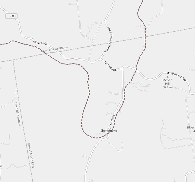
Shekomeko, New York

Shekomeko was a small historic hamlet in eastern Dutchess County, New York. Originally a village of Mahican Native Americans, the name Shekomeko was derived from their Algonquian language: she, -che (from mishe or k'che), 'great,' and comaco, 'house,' or 'enclosed place'—'the great lodge,', or 'the great village.'" 
(click on any graphic to enlarge)


Native Americans and the Moravian Mission 

The village has a fascinating history.  It was Moravian mission and in the summer 1742, Shekomeko was established as the first native Christian congregation in America. The increasing Moravian influence and their success with the Native Americans led to resentment by European settlers in the area. False rumors of atrocities were spread and the authorities were petitioned to intervene. A law was enacted on September 21, 1744 forbidding anyone from residing with Indians in order to Christianize them.
Shekomeko village and Moravian mission, 1745

By 1746, area settlers petitioned the governor to issue to them a warrant authorizing the killing of Shekomeko Indians. Shortly thereafter the mission was abandoned and the ten remaining families--a mere 44 persons where all that remained of the original 8,000 member tribe 100 years before--sought refuge in nearby Connecticut, while others traveled to Pennsylvania to be closer to the established Moravian settlements there.

A Railroad is Built

Construction on the Dutchess and Columbia Railroad began in 1868, and by 1869 the line reached north to Pine Plains. Construction then continued eastward through Shekomeko reaching Millerton in 1871. In 1877 the railroad was reorganized as the Newburgh, Dutchess and Connecticut Railroad (ND&C). In 1905 the New York, New Haven and Hartford Railroad acquired the ND&C and in 1907 merged it into the Central New England Railway.
Click any image to enlarge it


Sadly in 1925 the railroad line from Shekomeko east to Millerton was abandoned. Then in 1935, the line from Shekomeko west to Pine Plains  was abandoned and by 1938, the entire railroad line was abandoned. Traces of the roadbed can still be found in places.

Today

There's little left of the village now as this google aerial illustrates but there is a monument dedicated to the Moravian Christian Mission that was dedicated by the NY Moravian Historical Society in Oct 5, 1859.
Photo Credit: WindingRoad

Further Info

The Moravian Mission
(The Little Nine Partners Historical Society)

Shekomeko:
The Mohican Village that Shaped the Moravian Missionary World 

^ (excellent)

Shekomeko, New York (Wikipedia)

The Dutchess and Columbia Railroad
(The Little Nine Partners Historical Society)

History of the Moravian Church (Wikipedia)

Friday, August 9, 2019

Native American History - New York State

Being equally fascinated with historical maps AND Native American history in upstate New York where I grew up - this post is a result of online research. There is a wealth of materials out there if you look :-)

Click on any Map for an enlargement and better yet, go to the link provided to see the the full version where you can zoom in and pan


-Part One-

New York State Library - Native American Materials
The New York State Library holds a wealth of first hand descriptions of the Native American experience in New York. These resources span four centuries, beginning with the Dutch colony of New Netherland and continuing to the close of the American frontier in western New York and beyond. Original manuscripts and maps serve as lenses through which cultural and historical interpretations can be made.

The Five Nations - 1747
A map of the country of the Five Nations belonging to the Province of New York, and of the lakes near which the nations of far Indians live, with part of Canada.
Created By: Bradford, William, 1663-1752
http://purl.nysed.gov/nysl/51719615

Six Nations and New York Province - 1771
Copied from the original map drawn by Guy Johnson in 1771, this map was printed in The Documentary History of the New York by E. B. O'Callaghan, volume 4, page 661.
Created: 1851
Guy Johnson came to American in 1756 and was the Irish-born nephew, son-in-law and protégé of Sir William Johnson. He became a deputy to Sir William Johnson in his uncle's position as British Superintendent of Indian Affairs and succeeded him when William died in 1774.

Iroquois Cantons Map - 1747
Map indicating "sites of Indian Village and Jesuit missions, in the 17th and 18th centuries, in relation to modern towns.
Created By: Beauchamp, William Martin, 1830-1925
http://purl.nysed.gov/nysl/44687294

Indian Trails in New York State - 1755
Map showing trails, portages and settlements from Albany to Niagara during Sir William Johnson's tenure as "Sole Superintendent of the Affairs of the Six United Nations, their Allies and Dependents" which he held from 1755 until his death in 1774.
Created by: Mitchell, Louis (based on the papers of Sir William Johnson, outline of trails furnished by W.M. Beauchamp)
http://purl.nysed.gov/nysl/44714090


-Part Two-

Historical Maps from the David Rumsey Historical Map Collection...

Indian Reservations in the Northeast (1840)
Published in 1932 by the Carnegie Institution of Washington, American Geographical Society of New York
David Rumsey Historical Map Collection
Indian Territory - Published 1836
Map of the Indian Tribes of North America about 1600 A.D. along the Atlantic and about 1800 A.D. westwardly. 
David Rumsey Historical Map Collection
Patents NY State showing Indian Reservations - 1895
David Rumsey Historical Map Collection
1763 - Map of Colonial Possessions (published in French)
"Possessions Angloises & Francoises du Continent de l'Amerique Septentrionale"
David Rumsey Historical Map Collection

-Part Three-

Plundered in Search of Indian Artifacts
For more than 3,000 years, this alluring isle of stone in the Hudson River north of present-day Kingston has beckoned strangers.  Native Americans took shelter in a west-facing sandstone rock shelter and pulled mounds of shellfish from the river.
Location - Google Maps
Strangers still come to Magdalen, but now they arrive with shovel in hand to dig up arrowheads and other prehistoric artifacts illegally. Because Magdalen is half a mile from the Dutchess County shore, they work undetected and largely undisturbed. The quarter-mile-long island is so pockmarked with looters’ holes that parts look more like a bombing range than a state-owned parcel of land listed on the national and state registers of historic places.

Did you know about Kinaquariones?
Site of archaic Algonkian village. and old trail
Historic Marker
Ganondagan
Location of the largest Seneca village of the 17th century, Ganondagan is now a State Historic Site.


By Dmadeo - Own work, CC BY-SA 4.0,

Kanatsiohareke
Kanatsiohareke is a small Mohawk community on the north bank of the Mohawk River, west of Fonda, New York. The name means "The clean pots” or “Place of the washed pail”.

Ganienkeh
Ganienkeh (meaning Land of the Flint Mohawk), is a Mohawk community located on about 600 acres near Altona, New York in the far northeast corner of Upper New York State. Established by an occupation of militants in the late 1970s, it is a rare case in which an indigenous people reclaiming land from the United States "succeeded".

Kahnawà:ke 
Kahnawà:ke is one of eight territories that make up the Kanien’kehá:ka (Mohawk) Nation. The Mohawk Nation is a member of the Haudenosaunee or People of the Longhouse
Six Nation Iroquois Confederacy.
History & Culture

- details on their history, cultural regions, languages, etc.