Showing posts with label Forced Migrations. Show all posts

Thursday, September 12, 2019

How Human Activity Is Changing Animal Migration Patterns

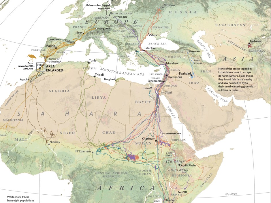
Humans have long tracked the movements of animals by following their paw prints or staking out their natural habitats. That kind of observation still has its value today, but now biologists also benefit from a slew of satellite, radio, and GPS technologies that can track the digital footprints of, say, a herd of elephants or a flock of storks as they move across the globe. And at a time when both climate change and urban development are changing—and disrupting—the migration routes, there’s a new urgency in these kinds of research.

In southern California, mountain lions are in decline in part because of the expansive freeways that crisscross the state. When researchers tagged a sample of lions in Santa Ana with GPS devices, they found their natural habitats divided by as many as eight lanes of traffic, as well as houses, golf courses, and other private developments.
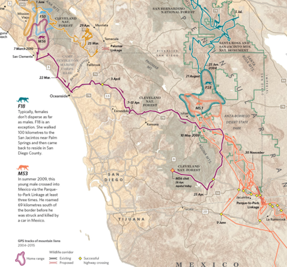

Despite proposals to build animal crossings after the fact, over- and underpasses have proven ineffective; they’re rarely used by the big cats. The risks go farther than just ending up as roadkill. The roads themselves become cages for mountain lion populations, isolating various groups and resulting in higher rates of inbreeding. This threatens their growth and survival as a whole.

Full article at Map Lab:

Its a fascinating read...

Tuesday, October 27, 2015

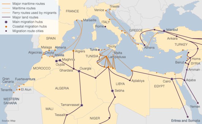
The Flow Towards Europe

Mapping the Frenzy of Europe's Migrant Crisis

The sheer scale of this migrant crisis has rocked the world and left European Union leaders grappling for solutions.

Only a small fraction of refugees fleeing their homes make it to Europe. The UN has registered four million Syrian refugees in Turkey, Lebanon, Jordan, Iraq, Egypt and North Africa. Most of them live in refugee camps close to the border. They would fit on 59 soccer fields.

Stats

  • Greece reported roughly 10,000 asylum-seekers a day arriving from Turkey. 
  • Around 680,400 people arrived in Europe just this year from crisis regions.
  • By the end of  015, Germany, Austria, Hungary, Sweden, the Netherlands, and Finland expect a total of 1.3 million asylum applications.
  • Syria has overtaken all other countries in refugee volume.

Article >

Amazing interactive motion map shows flows of refugees seeking asylum 

Interactive Map >

Each dot represents 25 to 50 people, depending on the device you use


Monday, September 21, 2015

The Migration Crisis In Europe

Hundreds of thousands of migrants are trying to make their way to European Union. The majority of them are from Syria, Iraq and Afghanistan...

Migration journeys to the European Union

Interactive Map >


Greece, on the brink of collapse

Article >

Out of Syria, Into a European Maze

Article >


Migration: Are there more people on the move?

Article >


Mapping Mediterranean Migration

Article >


Syrian Refugees

Monday, January 26, 2015

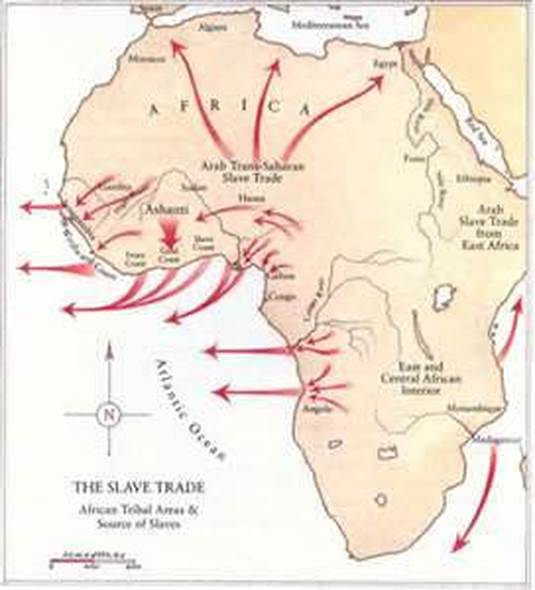
African Slave Trade - A Visual Quick Study

Between 1650 and 1860, approximately 10 to 15 million people were enslaved and transported form Western Africa to the Americas.  Of those transported, roughly 2 million died at sea.


Arabic Involvement - The Trans Saharan Slave Trade
Settlement by Ethnic Group U.S.A. 1755

Distribution of enslaved African Americans in 1850
U.S. Slave Concentration 1860

Domestic Slave Trade
Between 1790 and 1860, 835,000 slaves were moved from Maryland, Virginia, and the Carolinas to Alabama, Mississippi, Louisiana, and Texas.
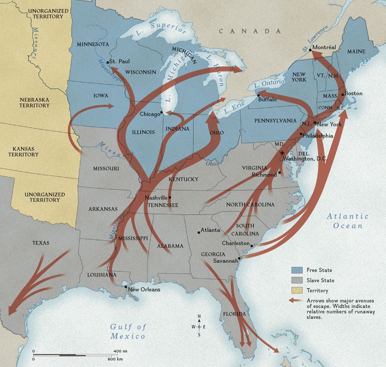
Domestic Slave Escape Routes 
 The "Underground Railroad"

Thursday, April 25, 2013

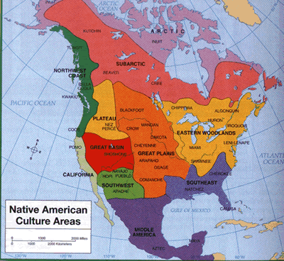
Native Americas (First Nations) - Visual Quick Study

- Click on any map for an enlarged version -

Native American Cultural Areas

North American - Native Language Groups

1600s


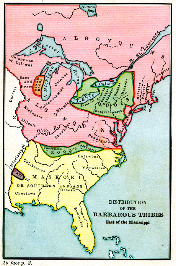
Distribution of the "Barbarous" Tribes East of the Mississippi    1491
A map of the Native American families and groups in North America east of the Mississippi River circa 1491. 

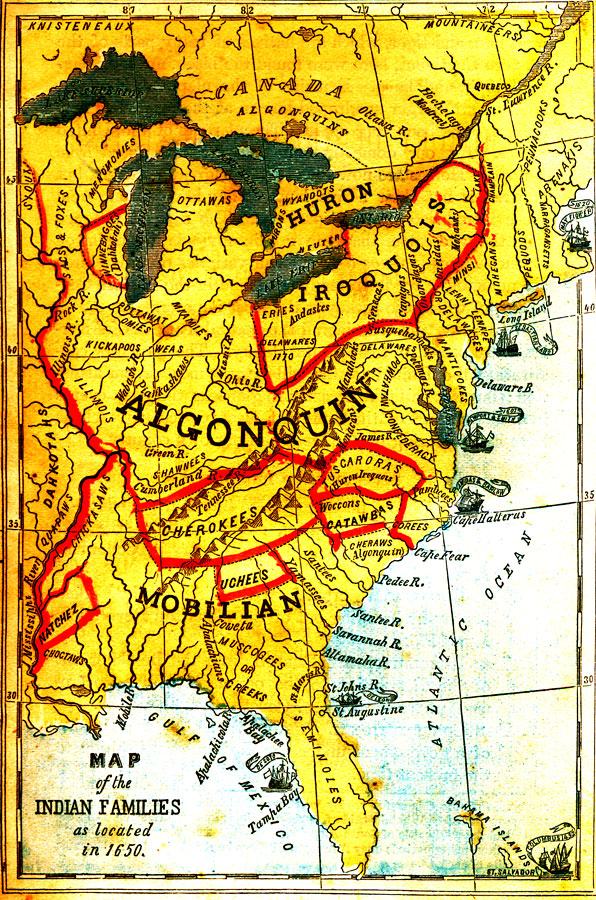
Map of the Indian Families, 1650
A map of the Native American families and groups in North America east of the Mississippi River as located in 1650. 

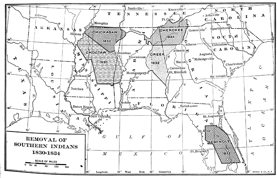
Removal of Southern Indians, 1830 to 1834

Forced Migrations


Native American Study 

  • Sad saga of deceit by U.S. government replete with colorful maps of Native North American Languages and the Trail of Tears   --  Recommended Reading >