Tuesday, May 31, 2016

Mongol Conquests

After reading this interesting book on the Empire of the Mongols, it behoved me to post maps and some of the pros and cons of this remarkable period in history.

Mongol Conquests

Historians regard the Mongol raids and invasions as some of the deadliest conflicts in human history up through that period. Some Hungarian historians claim that Hungary's long resistance against the Mongols actually saved Western Europe.

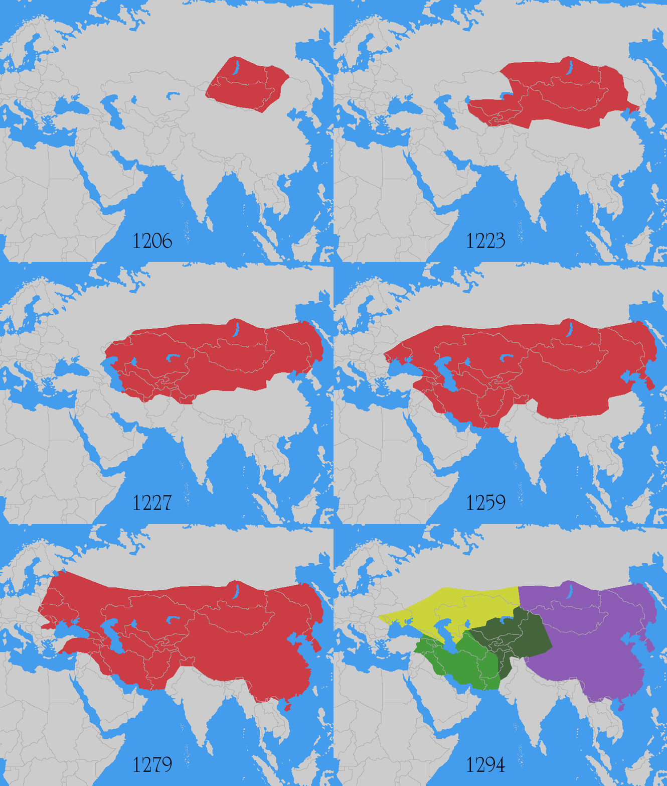
Under the leadership of Genghis Khan and his descendants in the 13th century, the Mongols quickly built an empire that stretched from Korea to eastern Europe - the largest continuous area of land ever controlled by one ruling family. The rise of the Mongols marked the last major clash between nomadic and sedentary cultures. 


Animated!
Barbaric, Mass-Murdering Hordes...

Ancient sources described Genghis Khan's conquests as wholesale destruction on an unprecedented scale in certain geographical regions, causing great demographic changes in Asia.

  • The total population of Persia may have dropped from 2,500,000 to 250,000 as a result of mass extermination and famine.
  • China reportedly suffered a drastic decline in population during the 13th and 14th centuries. Before the Mongol invasion, Chinese dynasties reportedly had approximately 120 million inhabitants; after the conquest was completed in 1279, the 1300 census reported roughly 60 million people.
  • About half the population of Kievan Rus' may have died during the Mongol invasion of Rus.;
  • Historians estimate that up to half of Hungary's population of two million were victims of the Mongol invasion of Europe.

...Or Enlightened Despots?

The Mongol army led by Genghis Khan subjugated more lands and people in twenty-five years than the Romans did in four hundred. In nearly every country the Mongols conquered, they brought an unprecedented rise in cultural communication, expanded trade, and a blossoming of civilization.

They united Eurasia in a truly international trading system, encouraged new forms of communication, and demonstrated the value of religious tolerance at a time when religious differences often led to wars.

Articles 


Tuesday, March 22, 2016

The Tragedy of Drying Lakes

Quite a few lakes throughout the world are drying or completely dry due to water diversion caused by irrigation or overwhelming urban demands. Its a tragic situation often with dire and monumental consequences. Three of the lakes are detailed below.

Lake Urmia - Iran

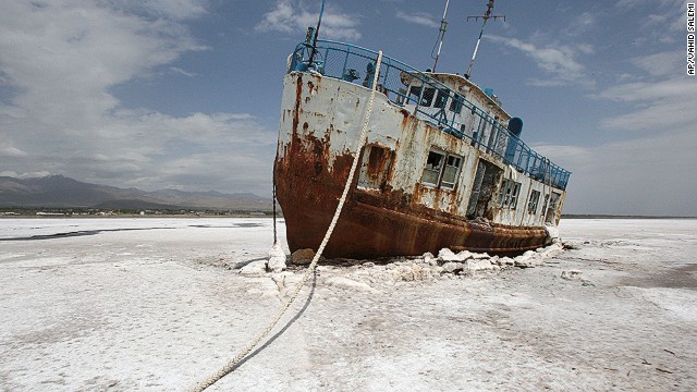
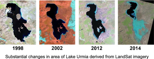
Lake Urmia is a drying salt lake near Iran's border with Turkey. At its former peak size, it was the largest lake in the Middle East and the sixth largest saltwater lake on earth.  The lake has shrunk to 10% of its former size since 1970 due to damming of the rivers that flow into it and pumping of groundwater from the area. Becase of its high salinity, the lake no longer sustains any fish species.


Aral Sea - Russia, 

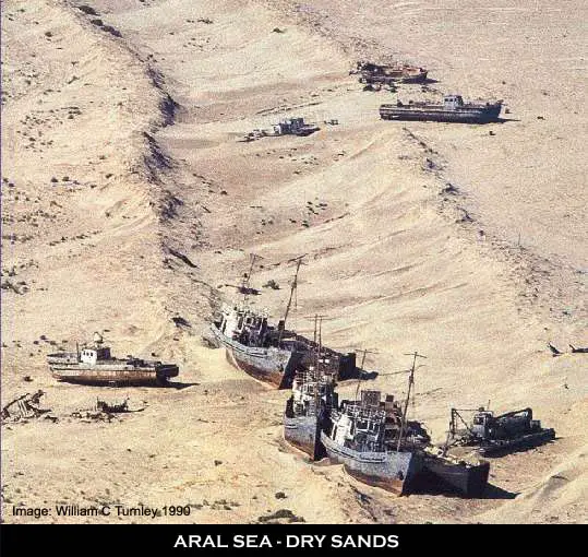
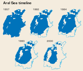
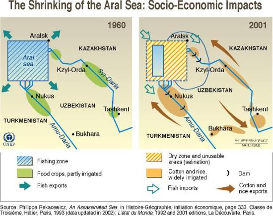
Formerly one of the four largest lakes in the world with an area of 26,300 sq mi, the Aral Sea has been steadily shrinking since the 1960s after the rivers that fed it were diverted by Soviet irrigation projects. By 2007, it had declined to 10% of its original size. Satellite images taken by NASA in August 2014 revealed that for the first time in modern history the eastern basin of the Aral Sea had completely dried up and is now called the Aralkum Desert.

The shrinking of the Aral Sea has been called "one of the planet's worst environmental disasters". The region's once-prosperous fishing industry has been essentially destroyed, bringing unemployment and economic hardship.

The receding sea has left huge plains covered with salt and toxic chemicals [the results of weapons testing, industrial projects, and pesticides and fertilizer runoff] which are picked up and carried away by the wind as toxic dust and spread to the surrounding area. As a result, the land around the Aral Sea is heavily polluted, and the people living in the area are suffering from a lack of fresh water and health problems, including high rates of certain forms of cancer and lung diseases.Vast salt plains exposed by the shrinking Aral have produced dust storms, making regional winters colder and summers hotter.


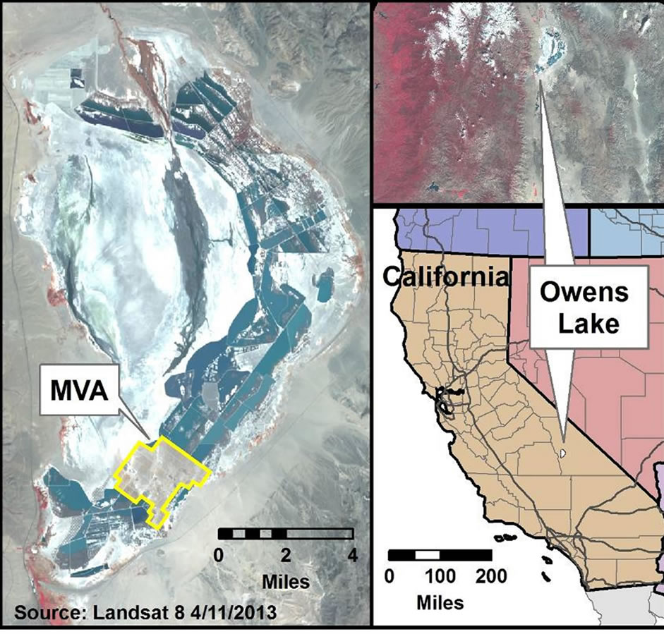
Owens Lake

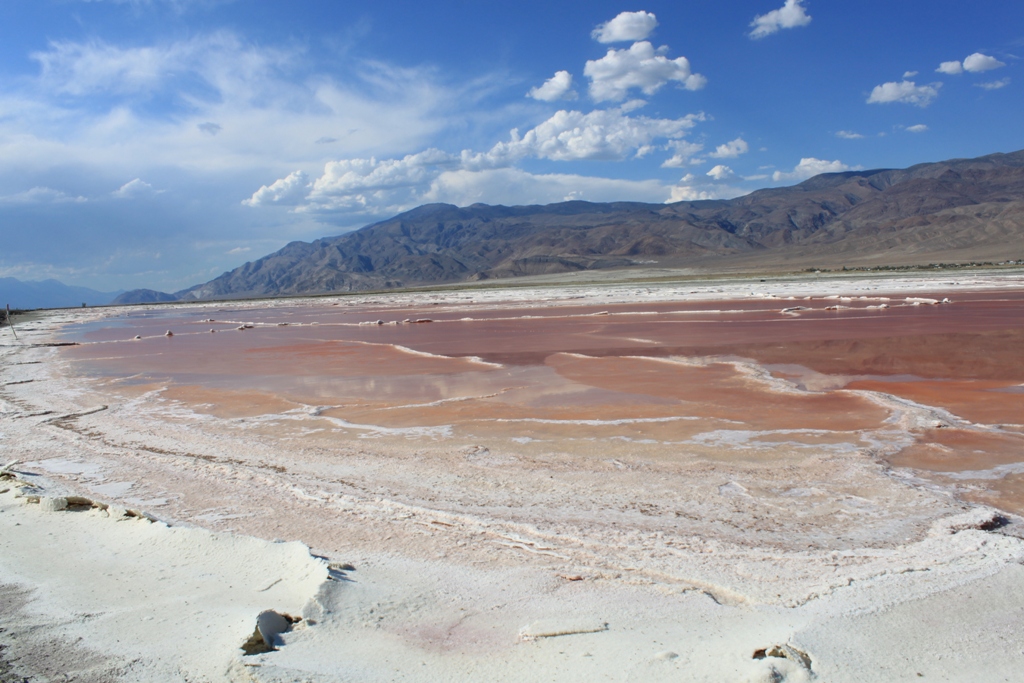
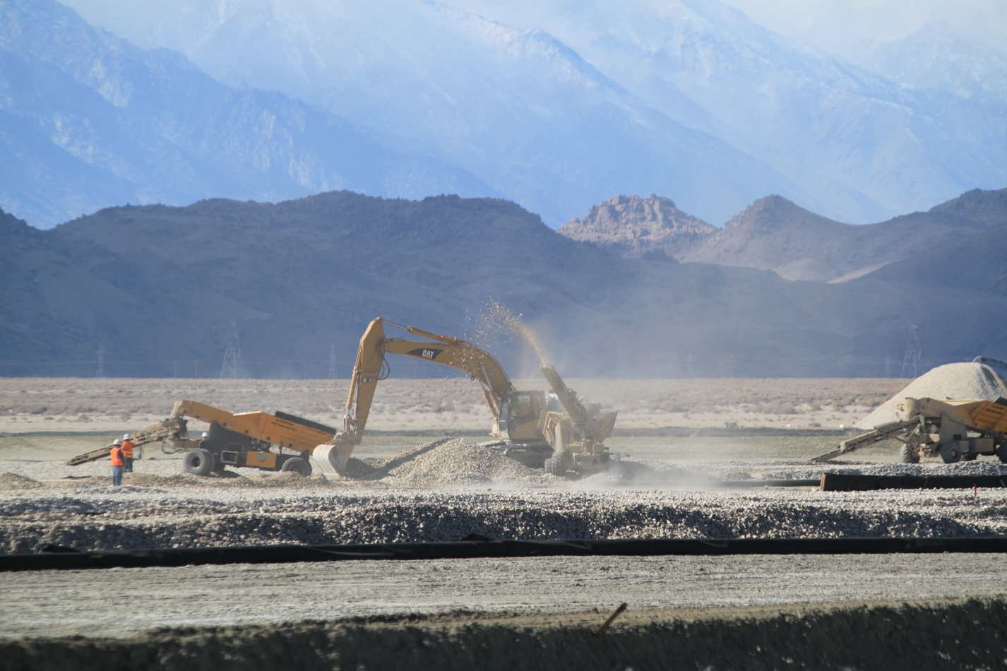
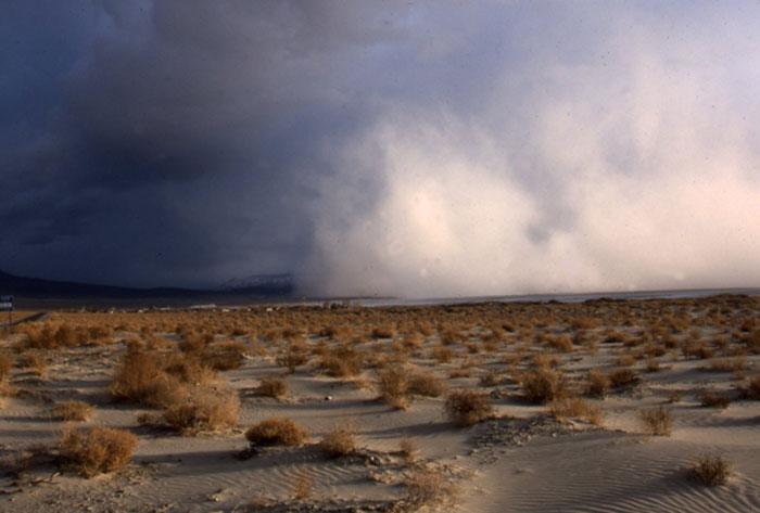
Now just a dry lakebed — a howling wasteland of toxic dust — Lake Owens once held significant water until 1913, when much of the Owens River was diverted into the Los Angeles Aqueduct. This caused Owens Lake to dry up by 1926. Although today, some of the flow of the river has been restored, tragically as of 2013 it is the largest single source of dust pollution in the United States.


Dust Storms

Bales of Hay are scattered in the dry lakebed to help minimize loose dust and dust storms.

Los Angeles Aqueduct

ARTICLES
Owens Lake (Wikipedia) >
Where Chinatown Began >
Flying Over Owens Lake During California’s Drought:
Owens Lake: Past Resent and Future >


List of Drying Lakes (Wikipedia) >


Tuesday, March 15, 2016

Visual Quick Study: Kurdistan


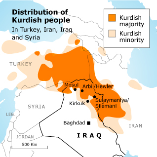
Kurdistan

Kurdistan roughly encompasses the northwestern Zagros and the eastern Taurus mountain ranges.


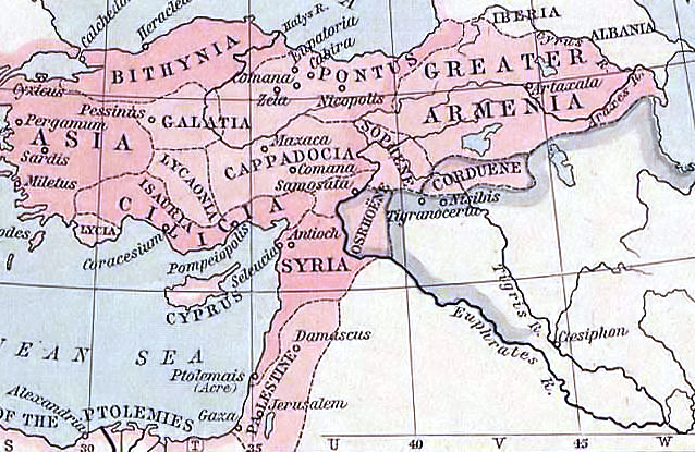
Kingdom of Corduene in 60 B.C


Medieval period

Kurdistan in the Middle Ages was a collection of semi-independent and independent states called "emirates". It was nominally under indirect political or religious influence of Khalifs or Shahs.

In the 16th century, after prolonged wars, Kurdish-inhabited areas were split between the Safavid and Ottoman empires. After the Battle of Chaldiran in 1514 up until the aftermath of World War I, most Kurdish areas were generally under Ottoman rule.

Kurdish Independent Kingdoms and Autonomous Principalities circa 1835.

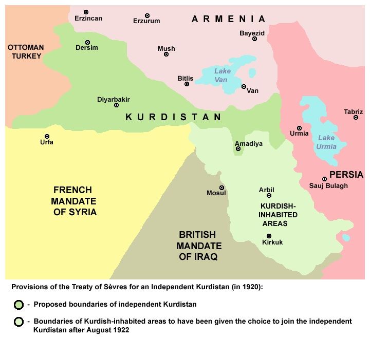
World War I and the Treaty of Sèvres

After the collapse of the Ottoman Empire, the Allies contrived to split Kurdistan among several countries, including Kurdistan, Armenia and others (as detailed in the ultimately unratified Treaty of Sèvres). However, the reconquest of these areas by the forces of Kemal Atatürk caused the Allies to accept the renegotiated Treaty of Lausanne and the borders of the modern Republic of Turkey, leaving the Kurds without a self-ruled region. Other Kurdish areas were assigned to the new British and French mandated states of Iraq and Syria.


Thursday, February 4, 2016

Decline of U.S. Railroads - Animated Maps

Railroad History has always fascinated me. The two animated maps below vividly illustrate the huge loss of railroad passenger service across America...


Map from the National Association of Railway Passengers 
and Malcolm Kenton via Greater Greater Washington.
Animation by Joss Fong
Slowed Down by Rich Coffey

Article >


Watch: The slow, sad decline of Amtrak
Source: http://media.mnn.com/assets/images/2011/05/amtrak-timeline.gif

Article >


Saturday, January 30, 2016

1924 Snapshot of New York State’s Trolleys

A series of ten mobile-friendly zoomable maps of various regions of New York State, detailing the interurban systems in 1924. The interactive maps are the centerpiece of the site but timelines and an abundance of links to other sites on New York State trolleys create an interesting history-saturated "launching pad" for research on this subject.


Other New England States will eventually be added as all.

Northeast Interurbans (A 1924 Snapshot) >