New York State Lands Interactive Mapper
An internet mapping tool that allows users to discover recreational features such as roads, trails, and parking lots on Department of Environmental Conservation (DEC) owned lands, print maps, and obtain supported information on the use of state owned forest lands.


State Lands Interactive Mapper (SLIM) >
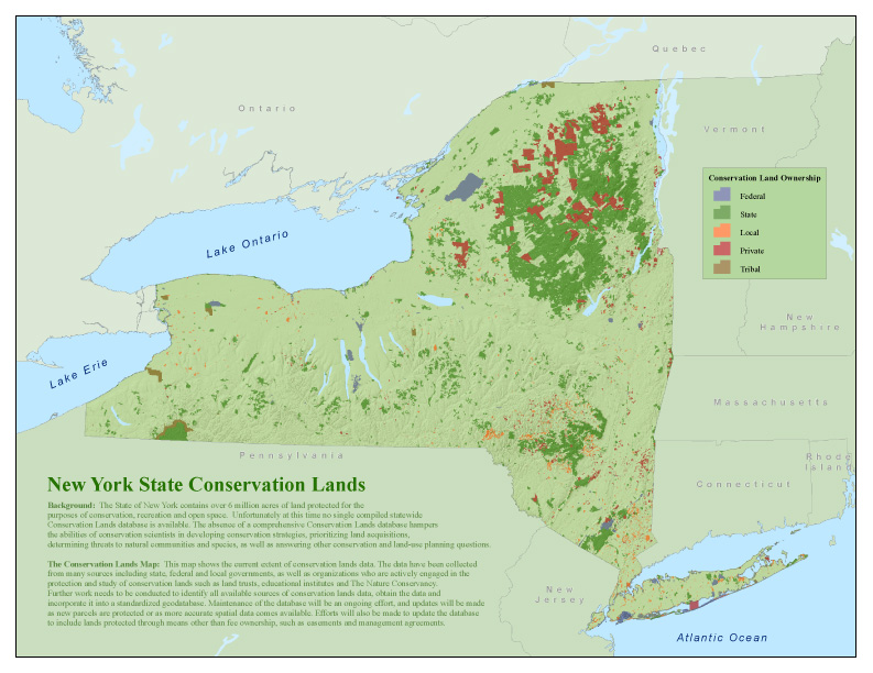
New York Protected Areas Database (NYPAD)
These lands cover over six million acres, approximately 20% of New York State.
No comments:
Post a Comment