Showing posts with label map. Show all posts

Wednesday, January 27, 2021

Six Places To Avoid

Six places most folks may want to avoid  :-). "Laugh of the week'"
Click on Google Map Link - these are for real!

1 - Google Map >

2 - Google Map >

Saturday, May 25, 2013

United States - Visual Quick Study

U.S. Climate Zones


U.S. Forests


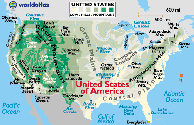
U.S. Mountain Ranges


(both kinda lame?)

U.S. Watershed


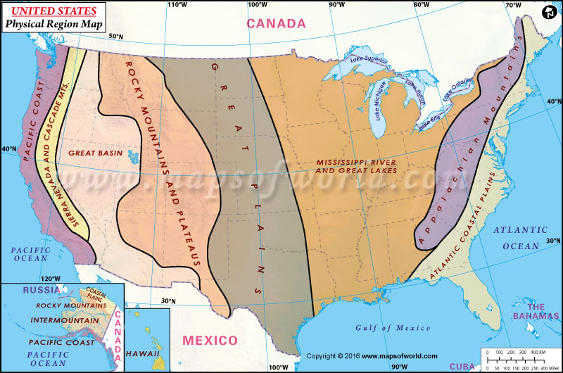
Regions


U.S. Rainfall


Average 1981 - 2010

Major U.S. Rivers


U.S. Population Density


In 3D

Thursday, February 14, 2013

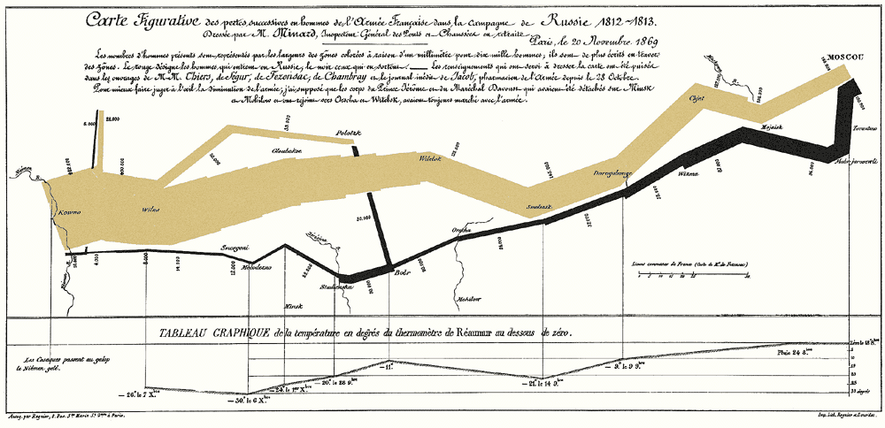
Edward Tufte's - March to Moscow


Edward Tufte's  - The March to Moscow

This is often considered the best statistical graph ever drawn.  The graphic depicts the fate of Napoleon’s army on its ill-fated Russian campaign during the winter of 1812-1813. The tan-colored band represents the march toward Moscow and the black-colored band represents the retreat back toward France...
Brilliant in its simplicity and clarity... 
Source:  http://www.edwardtufte.com/tufte/graphics/minard_lg.gif

Monday, January 28, 2013

GPS Bike Mapping

QUESTION:
What makes a great infographic?  
ANSWER:
The ability to combine a lot of data (information) into to an easy to understand Visual Display. The Ride With GPS App is certainly one of the cutting edge examples of this.


The centerpiece of the display is a log of the route of your bike ride superimposed on a Google Map. Interactive layered graphs of the ride data are available below the map and the whole interface can be viewed as am animated sequence from the playback control. There is an amazing amount of data available (Elevation, Speed, Grade, Time, Place, etc.) all available by an intuitive interactive interface.

Every control is easily accessed and data views can be collapsed/expannded, zoomed, etc. on the fly. 

MOUNTAIN BIKING EXAMPLES